
Follow LVIS
External Links
- 61A: Geodesy and Geophysics Laboratory
- Operation IceBridge
- ABoVE
- NSIDC
- GEDI
- GRACE
- University of Maryland
Recent News
LVIS featured on #ScienceInSeconds
28 Jul 2021
Dr. Michelle Hofton was interviewed for NASA Associate Administrator Dr. Thomas Zurbuchen's Twitter update during the 2021 GEDI Calibration/Validation campaign!
Greenland data available at NSIDC
14 Jun 2018
LVIS Level 1B and 2 data products from Operation IceBridge Greenland 2017 are now available at NSIDC. Links are now available here!
ABoVE data available at NSIDC
9 May 2018
LVIS Level 1B and 2 data products from ABoVE 2017 are now available at NSIDC, and the IceBridge 2017 data products have been sent out. Take a look here!
ABoVE data sent to NSIDC
8 Mar 2018
LVIS data from ABoVE 2017 has been sent to NSIDC. As soon as the data is available, links will be posted here!
Coweeta 2024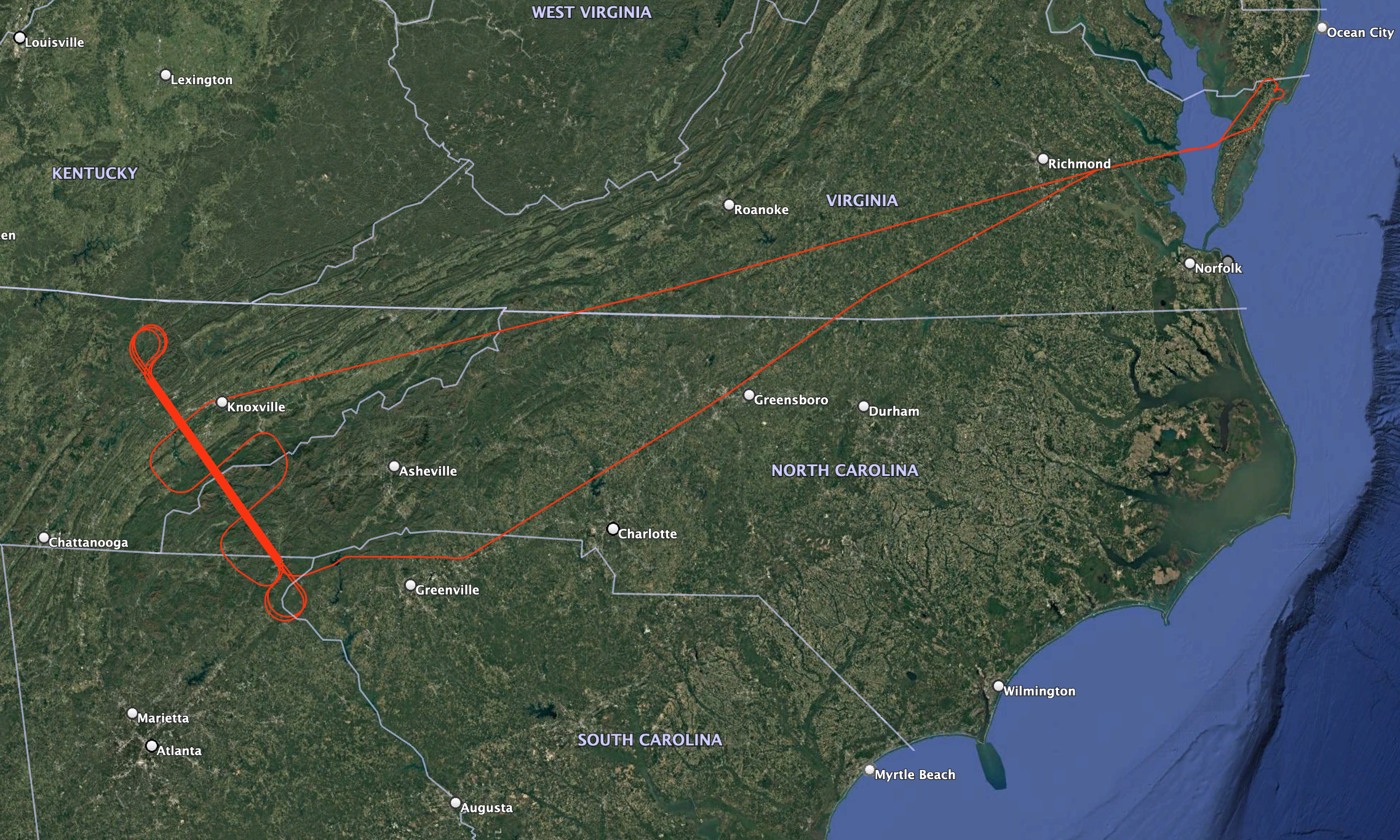
An Instrument performance checkout flight was flown over the Coweeta LTER and Oak Ridge areas in TN/NC on 9 September 2024 out of NASA's Wallops Flight Facility (Wallops Island, VA) Flight trajectory and camera imagery KMZ files are available for download below. Use the python code posted here to view the data products from this mission. |
LVIS Mission Information
|
Resources | ||||||||||||||||||||||||||||||||||||||||||
Data Products
| LVIS Data Products | Format | Download Location |
| LVIS L1A Camera Imagery | KMZ with browse JPGs | This page (see below) |
| LVIS L1A Camera Imagery | JPG* | NASA EarthData, NSIDC1 |
| LVIS Facility L1B Geolocated Waveforms | HDF, LDS 2.0.3 | TBA |
| LVIS Facility L2 Elevation and Height Products | ASCII TXT, LDS 2.0.3 | TBA |
1 At NSIDC, search for date 09 Sep 2024
*Image position and attitude embedded in exif data.
| View | MJD | Date | Region / Remarks | GPS Flight Trajectory | L2 Gridded KMZs† | Camera Imagery (KMZ)† | |
|---|---|---|---|---|---|---|---|
| CAM150MP | CAM050MP | ||||||
| 60562 | 9 Sep 2024 | Coweeta | [kmz] | TBA | [kmz] | [kmz] | |
†Warning: Gridded and Photo KMZ files are large and may take some time to load in Google Earth
