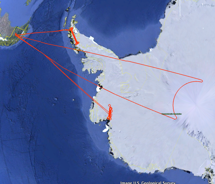
IceBridge 2009, Antarctica

In Fall 2009, LVIS co-mounted on the NASA DC-8 aircraft along with other Icebridge Sensors performed dedicated high-altitude, flights in Antarctica, performing large area maping of the Antarctic Peninsula and Pine Island Glacier, and the first survey of the 86S ICESat orbit maximum (dubbed the "polehole"). Data are available in both Level1B and Level2 formats. The Level1b data files contain the geolocated laser waveform data for each laser footprint. The Level2 data files contain elevations of reflecting surfaces derived from the Level1b data.


Level 2 files are much smaller and more manageable. For those users not familiar with waveform lidar data, we recommend that you start with the Level2 files before moving to the Level1b files (e.g., for context or to apply different algorithms). The Level1B data are in HDF5 and the Level2 data are in ascii.


Use the python code posted here to view the data products from this mission.


A description of the data products from this mission, along with their use for calibrating data from the ICESat sensor is:

Estimation of ICESat intercampaign elevation biases from comparison of lidar data in East Antarctica
Hofton, M. A. and Luthcke, S. B. and Blair, J. B.  Geophysical Research Letters,  40, issue 21,  5698-5703,  2013.  10.1002/2013GL057652

LVIS Mission Information

LVIS Lidar
Instrument Version: LVIS
Flight Platform: NASA DC-8
Nominal Flight Altitude: 40,000'
Nominal LVIS Swath Width: 2.4km
Nominal LVIS Footprint Diameter: 20m

Resources

Data Products

LVIS Data Products Format Download Location
Flight Trajectories KMZ This page
LVIS L1A Camera Imagery JPG* Coming Soon
LVIS L1B Geolocated Waveforms HDF, LDS 1.04 NSIDC1, NASA EarthData
LVIS L2 Elevation and Height Products ASCII TXT, LDS 1.04 NSIDC1, NASA EarthData

1 At NSIDC, search for date ranges 01 Oct 2009 through 30 Nov 2009


Display MJD Date Region / Remarks Platform Flight Trajectory
55124 20 Oct 2009 Pine Island Glacier DC-8 [JPEG] [PDF] [kmz] [shp]
55129 25 Oct 2009 Pole Hole DC-8 [JPEG] [PDF] [kmz] [shp]
55140 05 Nov 2009 Crane Glacier DC-8 [JPEG] [PDF] [kmz] [shp]
Oct - Nov 2009 All Antarctic 2009 Flights DC-8 [kmz] [shp]

Crane Glacier Gridded Products

File Size Format
NASALVIS_Crane_MJD55140_CentroidSurface.nc.zip 24 MB Zip
NASALVIS_Crane_MJD55140_CentroidSurface_EGM96.nc.zip 24 MB Zip
NASALVIS_Crane_MJD55140_CentroidSurface_EGM96.tif.zip 27 MB Zip
NASALVIS_Crane_MJD55140_HighSurface.nc.zip 24 MB Zip
NASALVIS_Crane_MJD55140_HighSurface.txt.gz 165 MB Zip
NASALVIS_Crane_MJD55140_HighSurface_EGM96.tif.zip 27 MB Zip
NASALVIS_Crane_MJD55140_HighSurface_EMG96.nc.zip 24 MB Zip
NASALVIS_Crane_MJD55140_LowSurface.nc.zip 24 MB Zip
NASALVIS_Crane_MJD55140_LowSurface.txt.gz 165 MB Zip
NASALVIS_Crane_MJD55140_LowSurface_EGM96.nc.zip 24 MB Zip
NASALVIS_Crane_MJD55140_LowSurface_EGM96.tif.zip 27 MB Zip