
Follow LVIS
External Links
- 61A: Geodesy and Geophysics Laboratory
- Operation IceBridge
- ABoVE
- NSIDC
- GEDI
- GRACE
- University of Maryland
Recent News
LVIS featured on #ScienceInSeconds
28 Jul 2021
Dr. Michelle Hofton was interviewed for NASA Associate Administrator Dr. Thomas Zurbuchen's Twitter update during the 2021 GEDI Calibration/Validation campaign!
Greenland data available at NSIDC
14 Jun 2018
LVIS Level 1B and 2 data products from Operation IceBridge Greenland 2017 are now available at NSIDC. Links are now available here!
ABoVE data available at NSIDC
9 May 2018
LVIS Level 1B and 2 data products from ABoVE 2017 are now available at NSIDC, and the IceBridge 2017 data products have been sent out. Take a look here!
ABoVE data sent to NSIDC
8 Mar 2018
LVIS data from ABoVE 2017 has been sent to NSIDC. As soon as the data is available, links will be posted here!
LVIS Data by Location. Click a map to download data.
Jump to Map for:
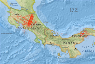
- 1998 Central America.
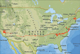
- 1999 USA (California, North Carolina, & New England).
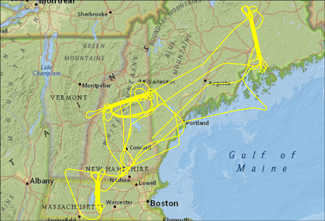
- 2003 New England.
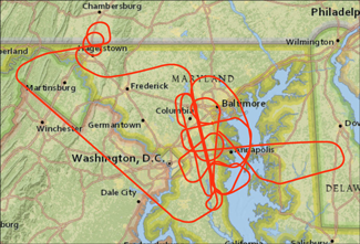
- 2003 Patuxent (MD, VA, DC).
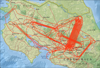
- 2005 Costa Rica.
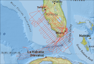
- 2005 Florida (Gravity Survey).
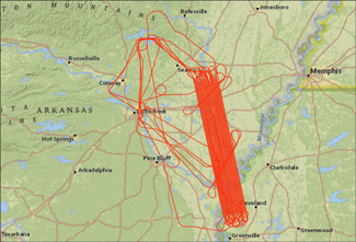
- 2006 USA (Arkansas, California).
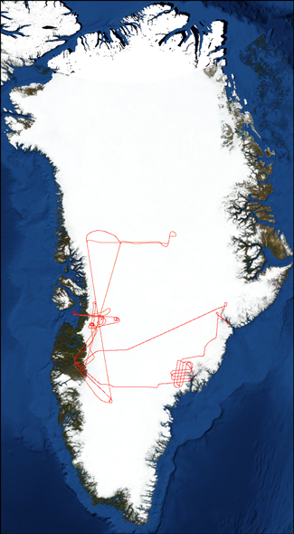
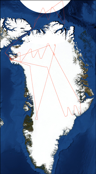
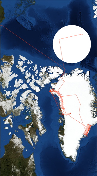
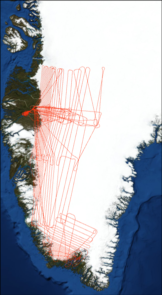
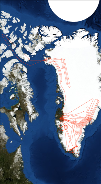
- 2007 Greenland.
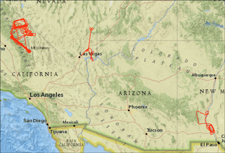
- 2008 Sierra Nevada, USA (California, New Mexico).
- 2009 Greenland.
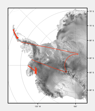
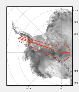
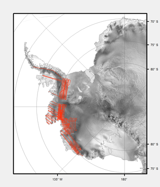
- 2009 Antarctica.
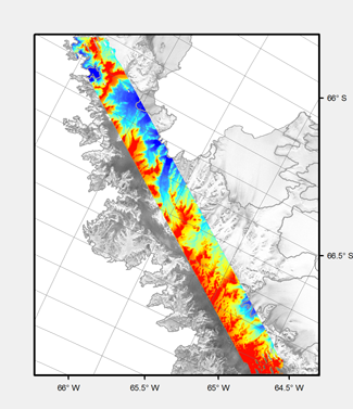
- 2009 Crane Glacier Gridded Products.
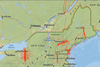
- 2009 New England (MA, ME, NH, NY) & Quebec, Canada.
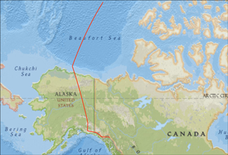
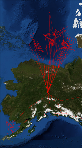
- 2010 Alaska.
- 2010 Greenland (Data Hosted at NSIDC).
- 2010 Antarctica (Data Hosted at NSIDC).
- 2011 Greenland (Data Hosted at NSIDC).
- 2011 Antarctica (Data Hosted at NSIDC).
- 2012 Greenland (Data Hosted at NSIDC).
- 2013 Greenland (Data Hosted at NSIDC).
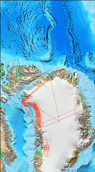
- 2014 Arctic ARISE Campaign (Data Hosted at NSIDC).
- 2015 Antarctica (Data Hosted at NSIDC).
- 2016 Gabon
- 2017 ABoVE
- 2017 Greenland (coming soon)
Return to the top of the page
